
The world of GPS or GNSS receivers is complex and can lead to misconceptions. Hence, this brief discussion about what information they can provide.
Measurements
Three pieces of information are output by virtually all receivers:
- 3D Position: latitude, longitude, altitude
- Derived from transit time for signal to travel from satellite to receiver
- 3D Velocity: speed along north, east, and down direction
- Derived from Doppler shift caused by relative motion between satellite and receiver
- Timestamp: GPS or UTC time
- Receiver clock gets synchronized with GPS time as part of signal tracking and position calculation
Notice that the source of position and velocity information are different. Simply approximating velocity using GPS position data will be far inferior to the velocity output by the receiver.
That is it. Other capabilities of receivers simply improve upon the quality of these outputs. A brief of description of the most popular follow.
Differential GPS (DGPS)
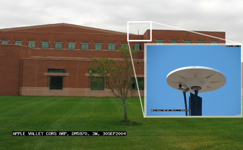
Photo of reference station in Apply Valley, MN part of the MnCORS GNSS Network
The idea of DGPS is that certain error sources which affect GPS or GNSS receivers are slowly varying and uniformly affect a large area. Hence, if a second (often called reference) receiver is installed at a fixed and known location, it can estimate these errors. Once, known, these errors can be shared with nearby receivers. Hence, several mutual and significant error sources get removed from the receiver, leading to better performance.
There are two types of DGPS capability which are described next.
Local-Area DGPS
A reference station is installed locally. For example, on the roof of an office or barn, or near the runway of an airport. Alternatively, it can be a reference station owned and operated by a government office like the U.S. Coast Guard. To use these corrections a receiver needs to be:
- Close enough to the reference station for the corrections to be valid.
- Connected to a data link which shares these corrections.
The data link requirement adds another layer of hardware. This is why the second type of DGPS, which is described next, is popular and almost standard on most receivers.
Wide-Area DGPS
In this case corrections are coded in a GPS-like message and transmitted from a geostationary satellite to your receiver. Hence, a GPS or GNSS receiver can receive these corrections without requiring any further hardware. Furthermore, many receivers can further utilize the geostationary satellite signal as it would any other GPS satellite signal.
But how does this geostationary satellite know what corrections to broadcast? The source of these differential corrections are a network of receivers installed and maintained across a nation or continent. This network of receivers are used to compute corrections for a wide area, and that information is regularly beamed to geostationary satellites which can then shared these corrections with all capable receivers.
This source of differential corrections is generically referred to as Satellite Based Augmentation System or SBAS. Examples of specific SBAS systems include WAAS or EGNOS, belonging to the US and Europe, respectively.
Real Time Kinematic (RTK)
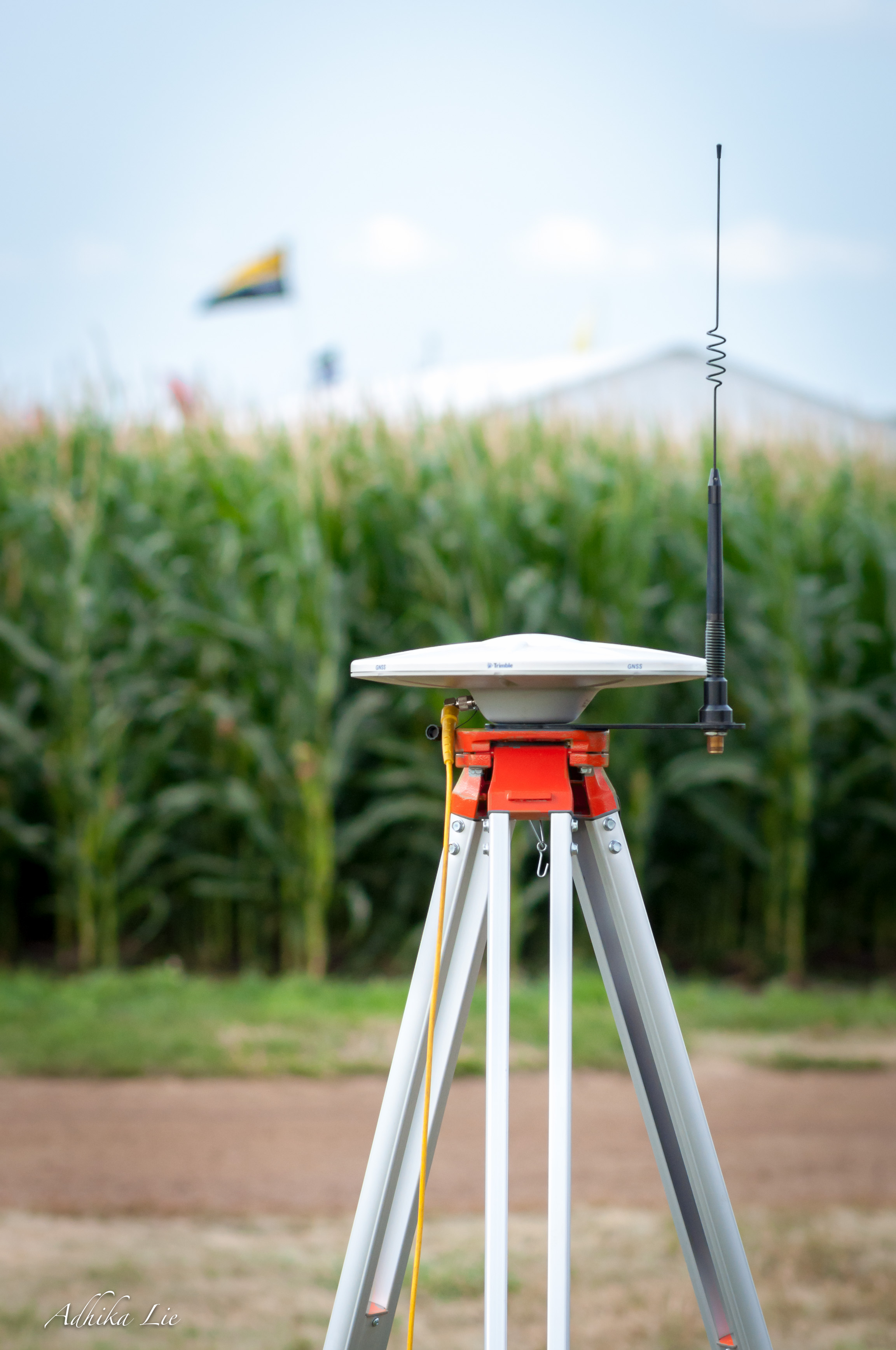
Photo courtesy of Adhika Lie
RTK-capable receivers use another form of satellite measurements to compute position and velocity. This is called carrier phase measurements and can enable centimeter-level positions to be calculated. Not unlike Local-Area DPGS, RTK-receivers generally require being paired with a base-station and hence an appropriate data link. These two receivers are often called base and rover. Alternatively, if real time is not required, the base and rover receivers can log independently and post-processing can be used to take advantage of the carrier phase measurements.
Carrier phase measurements, while very precise, are also very brittle and can easily be lost due to obstructions or interference. Thus, RTK works best in unobstructed environments and may be completely unusable in many conditions.
Comments